 1 / 7
1 / 7
- Property type
- Land
- Bedrooms
- -
- Bathrooms
- -
- Style
- -
- Land
- 44.3 acres
Our summary
This unique opportunity offers 17.93 hectares of IACS-registered agricultural land and a former railway line in Banff. The land features gently sloping fields with good soil quality, suitable for arable cropping and livestock grazing, and is located just 323 meters from the coast. It includes direct access from the A98 road and is classified as Protected Land within the Aberdeenshire Local Development Plan 2023.
Description
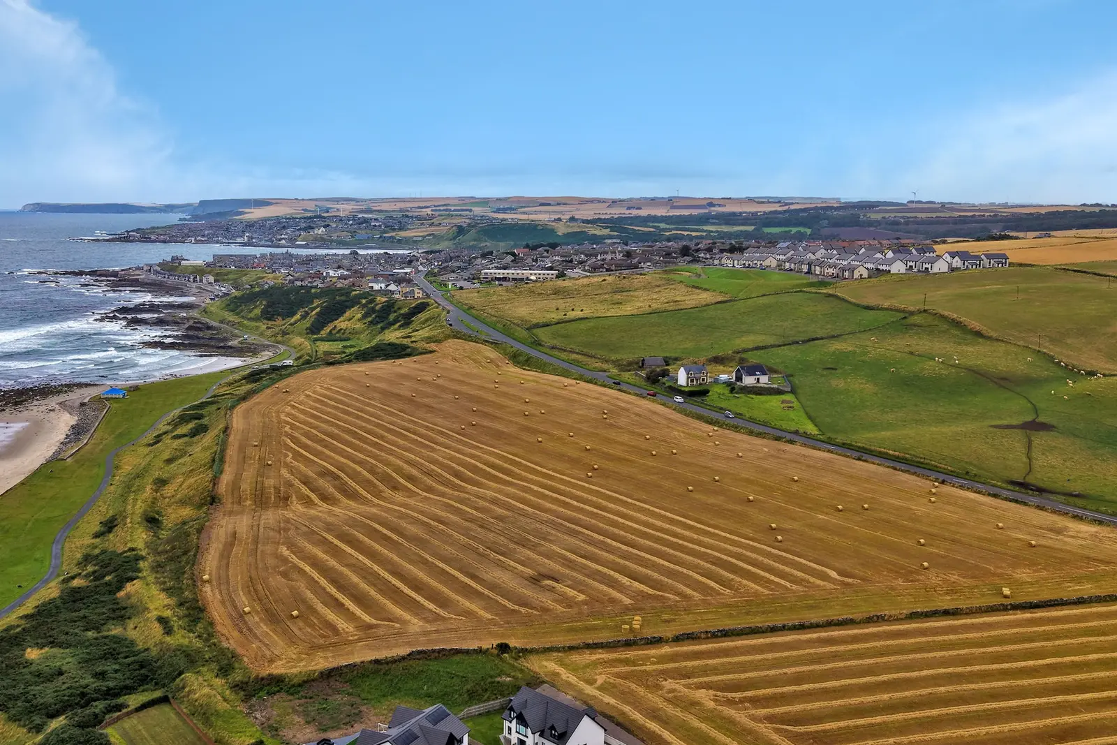
Unique opportunity to acquire 17.93 hectares (44.29 acres) or thereby of IACS-registered agricultural land & a former railway line in an accessible location.
Lot 1 (shown in red on the sale plan opposite) comprises two field parcels to the north of the A98 road extending to 9.84 hectares (24.31 acres) or thereby. Lot 1 also includes 1.45 hectares (3.57 acres) of land along the line of the former Banff railway line branch, situated in-between the former railway halts of Bridgefoot and Golf Club House which both closed in 1964 before the railway line closed to traffic completely in 1968.
The land slopes gently in a north-westerly direction towards the coast, lying at an altitude of between 15 and 25 metres above sea level. Fields 1 and 3 are classed as grade 3(2), with an area of grade 4(1) lying along the northern portion of the former railway line. Fields 1 and 3 benefit from Brown Earth soils with these well configured field parcels having been utilised predominantly for arable cropping in recent years. Fields 1 & 3 both benefit from direct access from the A98 road.
The entirety of the above subjects are included within site P1 (classed as Protected Land) within the Inverboyndie settlement boundary in the Aberdeenshire Local Development Plan 2023. Further information on this designation can be found in the planning section of the Aberdeenshire Council website.
Lot 2 (shown in blue on the sale plan opposite) comprises two field parcels extending to 6.64 hectares (16.41 acres) or thereby. The land is situated on the south side of the A98 road a short distance to the west of the suburbs of Banff.
The land slopes gently to moderately in a general north-westerly direction at an altitude ranging from approximately 25 to 50 metres above sea level. The majority of the land is classed as grade 3(2), with a central area being classed as grade 4(2), and the soils are a mix of Brown Earths and Mineral Podzols. The fields have been utilised for livestock grazing, with field 4 benefitting from direct roadside access to the A98 road.
BPS Entitlements:
Not included in the sale. Fields 1-4: BPS Region 1. NLFA
Local Authority:
Aberdeenshire Council, Woodhill House, Westburn Road, Aberdeen, AB16 5GB.
Entry:
The Seller has issued a Neighbouring Farmer with a Grazing Let and SLDT. The Neighbour, with whom the Seller has a good relationship, has agreed to vacate the Subjects on 01 December 2026 to allow a smooth transition to the new Owner. This Agreement can be viewed by any prospective Purchaser.
Mineral Rights & Sporting Rights: Included in the sale, insofar as they are owned.
Note:
Prospective purchasers should note that unless their interest in the property is formally intimated to the selling agents following inspection, the agents cannot guarantee that notice of a closing date for offers will be advised and consequently the property may be sold without notice.